Sunday, December 27, 2009
Reaching Harischandragad
After a very hard and tiring climb , all of us successfully and unscratched made to the top of the hill. I thought we were very close. But to my surprise, it took us another 2-3 hours to end our trek. But the trek never ceased to be exiting to say the least.
In fact, it started getting even more exiting. As we climbed a small hill the rain came down so heavily that it felt like they were stones being thrown at us. And the wind that was blowing, don't even ask me! I felt like I was being carried off, with that huge backpack that all you guys have seen in the pics.
I then made a huge goof up. The fog started coming down (we you can say that we were also going up! ;) ), is sometimes fogged up so much that it was even difficult to see 5 meters ahead. There were these little arrow marks that point to the direction of the final point. We reached a point where the fog came down heavily, there were rocks onto my right which were slippery and seemed like there would be no way in that direction. But to my left there was this beautiful trail. I took the trail and kept walking. After walking for almost 15 minutes, the trail was getting darker and darker and we started seeing hood prints and paw prints of animals. Even the branches over the route was closing in. After a point we decided that I had chosen the wrong route and we trekked back.
Now there was three options for us to get out of there. One was to go back the way we came till will meet some team , take the route that we had just taken or wait there till some team catches up. Just then, Jana spotted a team on top of the hill we just crossed. We spoke to them, just then the fog cleared up and the leader of that team showed us the route. Guess what, we had to climb down that rocky patch and cross a small stream and on the other side was this beautiful beaten trail.
Holy cow, what a big Idiot I am. There was rocky patch, covered by fog due to which I can't see what's on the other side and there was this trail with an arrow mark on it saying this is the route and I just could not guess that we had to take the rocky patch. Damn, I went to the wrong school! lol
After walking for little bit more and taking in the scenic beauty, the smell of the soil, the green grass and the beautiful fog all around us we reached our point. Even here we hit a road block(While there was no road to block, I literally hit it. ) We reached an ancient temple like structure and we were sure that we had reached the end point, But the problem in that, we knew there are caves where we had to stay but we could not even seen 5 meters ahead of us. Jana started walking ahead saying that he could see something. I followed him screaming to him to halt and move slowly, when all the while I was telling the guys to watch their step stepped onto a slippery rock and band went down. I hit my left side. My head banged up against the rock and I started bleeding right near my left ear. Welcome to Harischandragad.!
slippery rocks of harischandragad
I looked down, with a huge valley right below me. There was not even a single piece of rock that could have broken my fall. But I shook it of in a second and completed the climb. But for me, the even scary part was looking down and bending down trying to help the other guyz up. One slip of hand or foot would not only take me but also the other person. But, IMHO , this trek was worth it.
As we moved along, Jana started falling back every now and then and Anand started catching up. I had actually asked Jana to be the tail man. Anand was telling us that Jana was getting cramps. We didn't give it much importance and moved on thinking that stopping would be the last thing that we should be doing right now. But as we got to a level point, we took a break. Even after waiting for 5 mins Jana and Omkar had not joined us. I knew they were right behind us, but for some reason could not take the last steps. So I went back and I could not believe my eyes. Jana was sitting on a rock, with his calf muscles so tightened to hell that a few more minutes of walking would have turned it to the front! I sat down next to him. Started massaging his legs for some time. He was back to business in about 5 mins, and we continued our trek.
There were a few more trekking groups, one or two overtaking us, and one or two returning. One of the returning teams, told us it was too risky to do the trek right now, so they are going back. Vow, we still were not ready to give up. As we walked along the small winding path, up and down the hill we just stood in our tracks. We just found out why the previous team was going back.
There was this freaking 300-400 meters height that we had to gain. That too, in short distance hike, walking on rocks that were wet and slippery, had only space for one foot at a time and most importantly, if you fall. you are going down not just that 300 meters but a lot more of what you have already gained. BTW, I should say here that our government understands the safety concerns of the trekkers and had put up Iron railings so that people don't fall off.
But, guess what, they forgot that there are people living there and should do something for them to earn a living. Else what? else nothing, other than those people would pullout the railing and sell them for what ever they can get. (And people get angry when somebody call us third world. lol)
Tuesday, December 22, 2009
Soon we reached Kubhi Phata and we embarked on our long walk to the base village for Kireshwar. We had our rounds of jokes, wise cracks under a clouded sky. But Miss K got an admirer on the way. Well, I stopped to talk to a local and check whether we were on the right path and as soon as I turned back, there was this dog, running around the team and Miss K was going berserk. The dog joined us for some distance, but when his territory was over, he went his way.
But it was just the starters, the main course was the view. We were walking towards a huge hill and by the side of a beautiful but large lake. The sun was hidden behind the dark clouds and the cool wind never stopped blowing. I felt like walking to heaven(especially with a chick on ma side! lol).
Very soon, after some phone calls and return calls over mobiles with no networks Miss K friends came, picked her up and went their way. We had a long walk to the starting point and the walk was awesome to say the least, there were these beautiful green covered hills with small water falls here and there far ahead, a big lake on our right and beautiful green fields on the left.
Omkar and Anand got tired a bit quickly, they were lagging quite behind. But for me, the surprise package was my uncle. I was prepared to race the guyz to the start point but not him. He just bet me hands down, especially with the wind blowing down the rain hard on to our faces. We reached our starting point in about half an hour, had a late breakfast and were on our way up hill.
Thick green bushes and trees, small ups and downs, giggles of local women coming back from the field, all just added to the intensity. Slowly we started taking the blind turns by the side of thorny bushes, and started seeing the rocks of these lovely hills up close. Getting to cross small streams overflowing was really unexpected but lovely. I was exited, some people would say over-exited, or even crazy. But its just me with mother nature.
Then we got our first of the series of shockers. We reach the first set of rocks we had to climb. Well that was not difficult, but they were wet, slippery with algae and water was flowing down on them. I have 3 inexperience people and a elder person on my side. I took the lead, was kinda afraid (did not tell that to my team mates because I was sure somebody would have popped the idea of turning back). I was too exited to turn back now.
The rocks were really wet and slippery, and those one leg at a time tracks were not the ones that were actually causing my concerns. Its the depth on the other side that was really scary. If u fall, its 100-200 ft straight down (that's at the beginning of the trek). I was even more scared about the team that was with me. Most of them had very little of this kind of trek experience if any, and I had never trekked with the rains coming down so hard. There were points also were the rocks were cut to make foot and hand holdings. Holy cow, guess what? At one point I had a big back pack and with 2 legs and 2 hands in the rock cuts I did the unthinkable. I looked down......
Thursday, September 3, 2009
Harishchandragad
Ok, I am back after a longgggggg time. After frustratingly long time I went on a trek to Harishchandragad on August 8 -9 , 2009, and after a frustrating long time posting about it.
Harishchandragad lies on the route from Mumbai to Ahmad Nagar, around 3 hours drive from Kalyan. There is a bus starting for Nagar from Kalyan ST bus stand once almost every hour, first bus is at 5.30 and last around 10.00. Harishchandragad is supposedly 4671 feet above mean sea level as per the wise old Wikipedia.
On this trek with me were 4 people. Jana, my cousin (who was with me for the pindari trek), One of my uncles , then another two cousins of mine, Anand and Omkar. We had planned that we would all meet up at kalyan station around 6 am and take at least the 6.30 bus in the morning. But Omkar played a master stroke and came almost an hour late. When he turned up at close to 7 I was so frustrated but that was not it. The fellow turned up with a small tour bag where as I had clearly told everybody to bring their change of clothes in a polythene bag, so that we could everything into two backpacks. Well, if somebody had not seen the color Red, they could have looked at my face! lol
As soon as we reached the ST bus station there was our bus waiting for us and on the first seat next to the door was this gal (Ok, Ok, now .... All u ppl who knw me, dnt gimme that smile, I am not gonna try antg here, so please rest in peace? lol). I and Jana dumped the bags next to the driver's seat and as soon as I turned, the gal ask me "Harishchandragad?". I said, " god bless Omkar". The seat next to her was vacant, i sat down, introduced and she started her story of her team going ahead and she trying to catch up. yipeee, now I was in mood for a trek.
But fate came as Jana, caught a seat at the back and started shoutn "Sunil, come back". I signalled and continued. But bro ddn't get the message, he called out again. Now , i can't sit there. Damn! I got up, said my good bye to the gal(lets call her K from now on) and moved back and as soon as I got to him he told me "that's conductor's seat" and I told him "dude, you do that again, u can kiss ur own head good bye".
We started a game of "who am I' and later on K also joined us. We had by now reached Malse Ghat the whole settings had changed. We started of on clear day (even though it was rainy season) and now we had fog all around us, that too at 9 am in the morning. It was starting to get cold and guess what, none of us could figure out how the driver was seeing the road. After lookn out for a few minutes we saw the tail lights of another bus ahead, and our driver was following it! Vow!
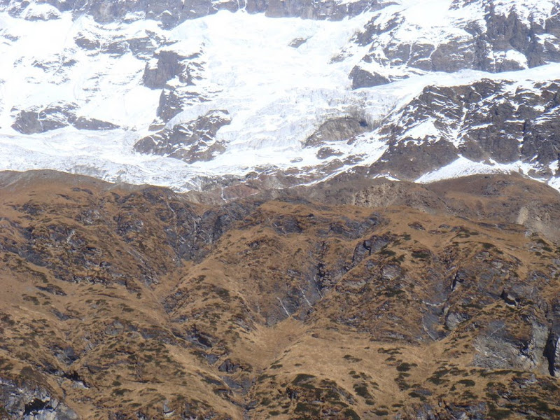
Harischandragad looks nothing the same in rainy season as in others. Just to prove the point. Take a look at these images.
ps. Guyz, I am so sorry that I can't help you with lot many pictures this time, since it was raining most of the time, the cameras rarely came out.
Thursday, March 5, 2009
Pindari Glacier- Himalayas Itenarary
Pindari Glacier, Uttaranchal, India
Schedule we followed (of trek)
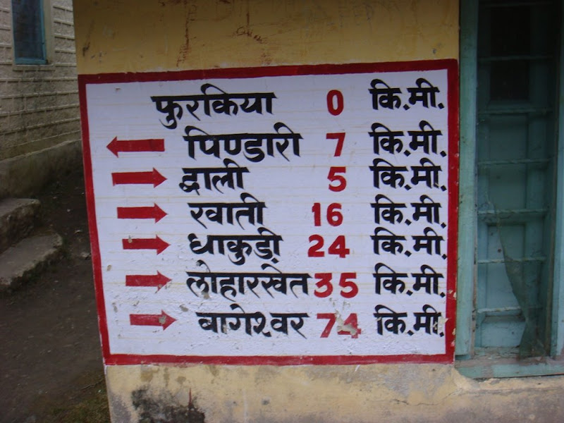
Day 1: Song- Loharket : 3 kms
Day 2: Loharket - Dhakuri : 11 Kms
Dhakuri - Khati : 8 Kms
Day 3: Khati - Dwali : 11 kms
Dwali- Phurkia : 5 Kms
Day 4: Phurkia-Pindari : 7 kms
Pindari-Phurkia : 7 kms
Phurkia-Dwali : 5 kms
Day 5: Dwali-Khati : 11 kms
Khati-Dhakuri : 8 kms
Day 6: Dhakuri-Loharket : 11 kms
Loharket-Song : 3 kms
We could do only Song-Loharket on day one as we started late and also the terrain was tough for us to adjust. You can do more. But staying at loharket may help you in acclimatisation also.
Ensure that you stay at Dhakuri at least for one night. If possible try staying at Pindari, i guess it should be good. But arrange for your own food there since baba does not serve after 5.30 in the evening. Try to stay at these places as there are guest houses here. At Pindari if you wanna stay you are by yourself other than for the helps from baba.
Altitude at various points in meters
Song - 1400
Loharket - 1600
Dhakuri - 2680
Khati - 2210
Dwali - 2575
Phurkia - 3260
Pindari - 3353 (altitude at the lowest point)
Expenses- We must have spent around about 6000 INR together. Inclusive of our travel charges and all. Since we had tent we did not stay in guest houses on trek or hotels while on road( except for one night-that too in a low budget one). We tried to travel at night as much as possible so as to avoid hotel stays.
If you have good trekking stuff like a backpack, tent and all that should be the expense that you should also be looking at. We almost always paid for lunch only between 30-40 rupees and also we not more than 17 rupees for breakfast comprising of Magiee.
Dwali-Khati-Dhakuri
Dhakuri
Dhakuri-Loharket-Song
Some Maps that may help (I don't own any of these, if owner has any objection it will be taken off)
Labels:
Bageswar,
Dwali,
himalayas,
Khati,
loharket,
Phurkia,
pindari glacier,
pindari travel itinerary
Pindari Glacier, Uttranchal
Loharket- Dhakuri
This is the toughest stretch in the whole trek . The locals say, if u make this distance. If you are not so sure about your hiking skils you can get a porter or a mule for just this distance. There are some awesome views and locales in this stretch.Dhkuri- khati
This is one of the easiset leg of the trek. Almost all the distance you are going down hill. It took us around 2 to 3 hours and we were not much tired. Keep some chocolates and sweets with you if you like kids as you are bound to meet a lot on the way and they are gonna ask you for them.
They wish you 'Namsate' ask for sweets and if they see your camera they will ask for a foto taken. Its upto you to oblige or not, no pressure.
Khati
Khati - Dwali
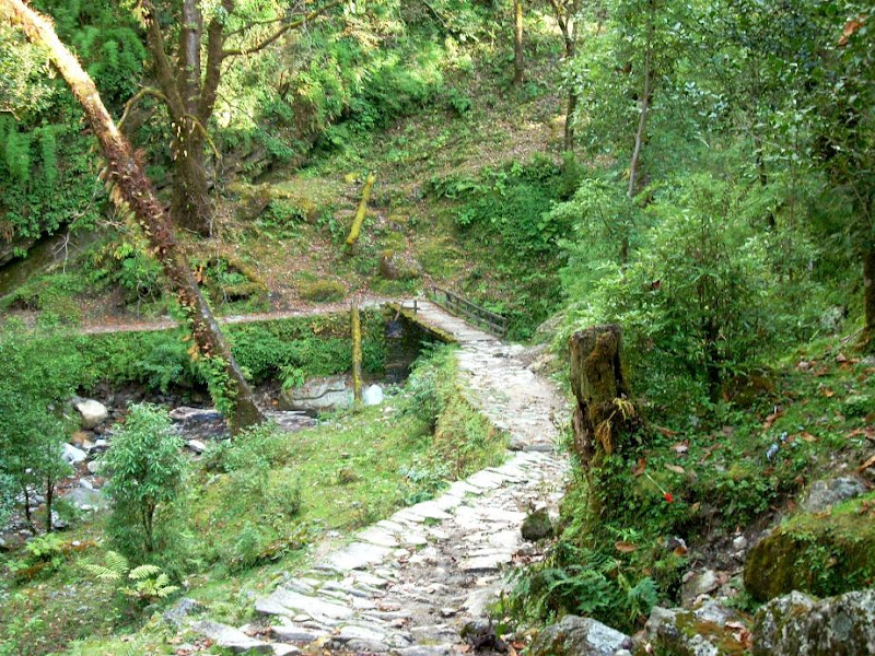
This route passes through dense forest. Expect to see a lot of Monkeys and variety of birds. If you are lucky (or unlucky) you may see a lot of wild animals also. This is a long ardeous trek, don't try to do it very fast, it will seem never ending.
Dwali- Phurkia
This first 1 km of this trek is quite difficult almost a vertical climb. After that though you will still be going up it won't be that difficult. There is huge change in the flora and fauna. The temprate also fluctutated a lot when we trekked adding to the exitment.
Phurkia
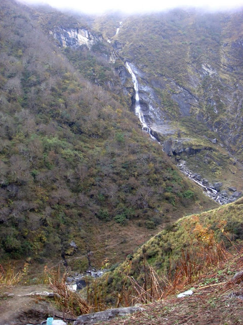
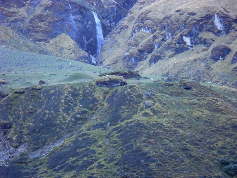
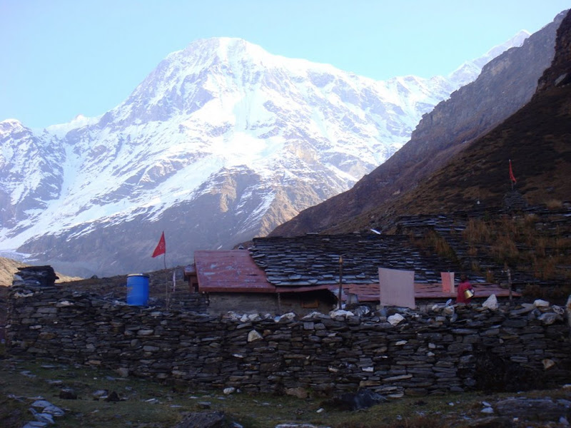
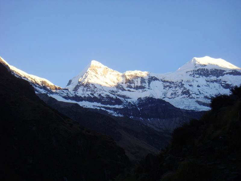
This is said to be the highest point of the trek, at around 3600 mts height. Awesome place to spent a evening and night. The cold winds, mist and the waterfalls from the near by mountains make this a special stop in the trek.
Phurkia- Pindari
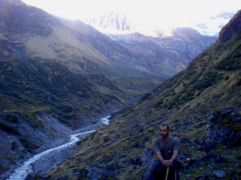
This is the final trek of 7 kms before you reach the destination point. Early morning trek makes this place even more beautiful, u will see huts of Nomads on the nearby hills and loads of horses.
Pindari Ground 0
Get to Pindari before 9 O clock in the morning or else it will be difficult to see the peaks as clouds cover them(this is aug-oct time, in summer u nead to reach earlier). Do meet the baba if he is there. Also if you have time stay a day here, next time I am suerly gonna do it.
Travel Itinerary
This is the toughest stretch in the whole trek . The locals say, if u make this distance. If you are not so sure about your hiking skils you can get a porter or a mule for just this distance. There are some awesome views and locales in this stretch.Dhkuri- khati
This is one of the easiset leg of the trek. Almost all the distance you are going down hill. It took us around 2 to 3 hours and we were not much tired. Keep some chocolates and sweets with you if you like kids as you are bound to meet a lot on the way and they are gonna ask you for them.
They wish you 'Namsate' ask for sweets and if they see your camera they will ask for a foto taken. Its upto you to oblige or not, no pressure.
Khati
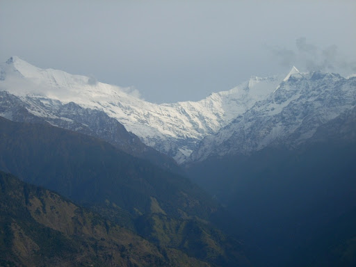
This is the last village before pindari. Khati has its place in history for Pandavas (the heros of Hindu Epic 'Mahabharata' had stayed here on their way to heaven). The people are really nice, there is lot of open space for tents. You can get beautiful view of the snow capped mountains from here.
Khati - Dwali
This route passes through dense forest. Expect to see a lot of Monkeys and variety of birds. If you are lucky (or unlucky) you may see a lot of wild animals also. This is a long ardeous trek, don't try to do it very fast, it will seem never ending.
Dwali- Phurkia
This first 1 km of this trek is quite difficult almost a vertical climb. After that though you will still be going up it won't be that difficult. There is huge change in the flora and fauna. The temprate also fluctutated a lot when we trekked adding to the exitment.
Phurkia
This is said to be the highest point of the trek, at around 3600 mts height. Awesome place to spent a evening and night. The cold winds, mist and the waterfalls from the near by mountains make this a special stop in the trek.
Phurkia- Pindari
This is the final trek of 7 kms before you reach the destination point. Early morning trek makes this place even more beautiful, u will see huts of Nomads on the nearby hills and loads of horses.
Pindari Ground 0
Get to Pindari before 9 O clock in the morning or else it will be difficult to see the peaks as clouds cover them(this is aug-oct time, in summer u nead to reach earlier). Do meet the baba if he is there. Also if you have time stay a day here, next time I am suerly gonna do it.
Travel Itinerary
Labels:
himalayas,
Khati,
Loharkhet Dhakuri,
pindari glacier,
pindari trek
Monday, March 2, 2009
Pindari trip's last moments
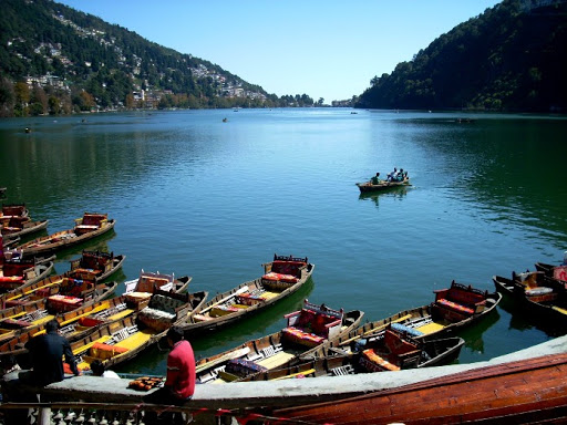
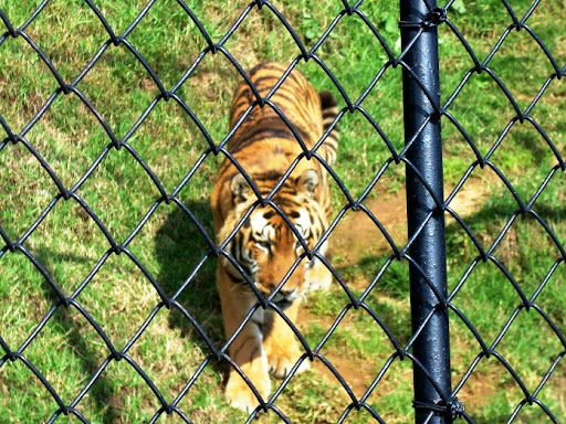
Next day morning we took a bus to Nainital at 5.30 am. The conductor was nice to explain us all the peaks we saw and also we reached Nainital via Kausani. Actually we had to get down around 20 kms before Kausani and jeep. We checked into youth hostel for 60 bucks per head. Then we checked out the famous Nainital Zoo, especially the big owl and the Siberian tiger. Well, there was one more interesting thing,there was this guy a big fat one shouting and howling at all the animals. The Siberian Tiger which came so close to the rails of its cage walked back to its small pond at the back and sat down as if it was watching some comedy show live. Damn, it must have missed some good beer....lol. Then in the night we checked out the Tibetan market. I really loved the Tibetan people. They were so nice. Jana had some momos to eat. We met a Tibetan girl in a bag shop while checking out a bag that looked like our backpack. She was cute, polite and lovely. Well, we are two jackals and we are brothers !! lol. We loved her so much that we stopped on our way back to apologize for not buying anything from her...lol(that was Jana's Idea, but i loved it ;) ).
What I am talking about, read from first or read the last entry.
Nainital has Youth Hostel which is pretty cheap for tourist destinations, 40 Rs for members and 60 for non members. It was pretty clean compared to other government maintained institutions
I bought some honey for my dad and Jana some honey and ginger essence for home. Next day we just went around to a small park, came back to the hostel, picked our backpacks and left for Ramnagar via Kaldungi. Ramnagar is the last rail head for Jim Corbett National Park. We had reservations for the night train to Delhi.
We reached Old Delhi by 5.30 in the morning. Jana and i woke up. Jana has to shit everyday morning, first thing (hahaha). We though this was the train's last stop as we had checked the time table. Jana hit the bathroom while i kept an eye on the luggage. Surprise, the train started moving. One guy who was inside the train told us that it was going to Shajahanpur. The train stopped near the KrishnaGargh station for signal and we hopped out. We bought two local train tickets for Nizammuddin and waited for the 6.30 local. Unlike Mumbai where a local comes almost every 5 mins the 6.30 local was first and came 15 mins late. In Mumbai local stops only 30 secs in a station and here its stopped for almost 20 mins. We reached Nizamuddin at 8.00 and I bought my newspaper. After almost 6 days. I really cant live without newz. lol
Our Mangala express arrived, we boarded, made new friends and we started. At Gwalior some sports guys also boarded and we all had some fun. Especially enjoyed playing with the 5 year old Anamika, the little girl who was sitting in the opposite coupe. Everybody was enjoying playing with her. We had a good sleep that day night. Next Day morning We reached Kalyan Station(a suburb of Mumbai). Jana's holiday was over, I was to continue my journey to Kerala to meet my grandma and parents after almost 2 years. I met my relatives who had come to pick Jana and we bade farewell. 10 days were over and we didn't even notice it and so was my Jana's first and my first Himalayan trek. Pindari was still large in our minds and hearts.
I will be finishing my post on my Pindari trip with a photo gallery, suggestions, budget and itinerary post. Which may help you to plan a trip to Pindari
The travel pics
Subscribe to:
Posts (Atom)